
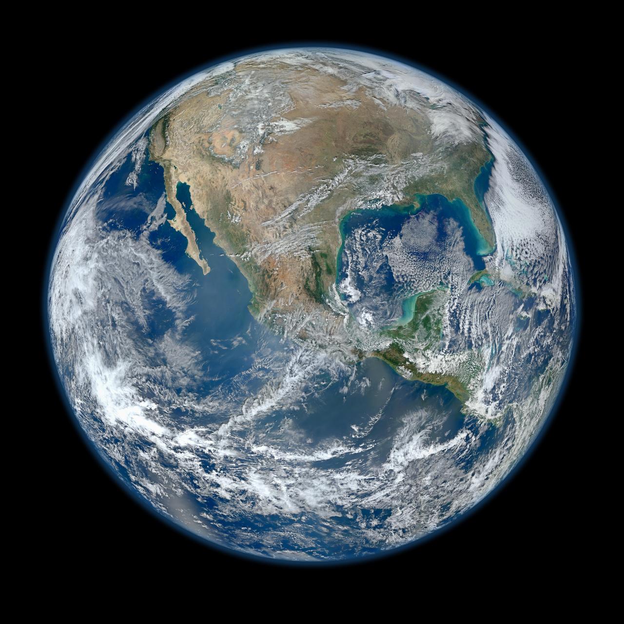
The Earth & Moon
During its flight, NASA’s Galileo spacecraft returned images of the Earth and Moon. Separate images of the Earth and Moon were combined to generate this view. http://photojournal.jpl.nasa.gov/catalog/PIA00342
1998-06-04

Earth - India and Australia
This color image of the Earth was obtained by NASA’s Galileo spacecraft on Dec. 11, 1990, when the spacecraft was about 1.5 million miles from the Earth. http://photojournal.jpl.nasa.gov/catalog/PIA00122
1996-02-08

Earth - Pacific Ocean
This color image of the Earth was obtained by NASA’s Galileo spacecraft early Dec. 12, 1990, when the spacecraft was about 1.6 million miles from the Earth. http://photojournal.jpl.nasa.gov/catalog/PIA00123
1996-01-29

Earth and Moon from 114 Million Miles
Earth and Moon from 114 Million Miles
2010-08-17

Earth - Moon Conjunction
Earth Moon Conjuntion image created during Galileo second flyby. http://photojournal.jpl.nasa.gov/catalog/PIA00134
1996-01-29

A Sky View of Earth From Suomi NPP
This composite image of southern Africa and the surrounding oceans was captured by six orbits of the NASA/NOAA Suomi National Polar-orbiting Partnership spacecraft on April 9, 2015, by the Visible Infrared Imaging Radiometer Suite (VIIRS) instrument. Tropical Cyclone Joalane can be seen over the Indian Ocean. Winds, tides and density differences constantly stir the oceans while phytoplankton continually grow and die. Orbiting radiometers such as VIIRS allows scientists to track this variability over time and contribute to better understanding of ocean processes that are beneficial to human survival on Earth. The image was created by the Ocean Biology Processing Group at NASA's Goddard Space Flight Center in Greenbelt, Maryland.
2015-04-22

Earth from Juno
On Oct. 9, NASA Juno spacecraft flew past Earth, using our home planet gravity to get the final boost it needed to reach Jupiter. The JunoCam instrument captured this monochrome view of Earth.
2013-10-21

Crescent-shaped Earth and Moon
This picture of a crescent-shaped Earth and Moon -- the first of its kind ever taken by a spacecraft -- was recorded Sept. 18, 1977, by NASA Voyager 1 when it was 7.25 million miles 11.66 million kilometers from Earth.
1999-05-15

South Polar Projection of Earth
This view of the Earth shows a wonderfully unique but physically impossible view of the southern hemisphere and Antarctica. While a spacecraft could find itself directly over the Earth pole, roughly half of the image should be in darkness!
1997-09-10

Earth - Departing Image by Galileo
This color image of the Earth was taken by NASA’s Galileo spacecraft on December 11 as it departed on its 3-year flight to Jupiter, about 2 1/2 days after the second Earth flyby. http://photojournal.jpl.nasa.gov/catalog/PIA00232
1996-02-08

NASA Earth Day 2019 Poster - Web
NASA Earth Day 2019 Poster - Web
2019-04-17

NASA Earth Day 2019 Poster - Print
NASA Earth Day 2019 Poster - Print
2019-04-17

Crescent Earth and Moon
This picture of a crescent-shaped Earth and Moon, the first of its kind ever taken by a spacecraft, was recorded Sept. 18, 1977, by NASA Voyager 1 when it was 7.25 million miles 11.66 million kilometers from Earth. http://photojournal.jpl.nasa.gov/catalog/PIA00013
1996-08-29

Earth - Full Disk View of Africa
This color image of the Earth was obtained by NASA Galileo spacecraft in Dec. 1990, when the spacecraft was about 1.5 million miles from the Earth. Africa stretches from the center to the top of the picture with the Arabian Peninsula off to its right. http://photojournal.jpl.nasa.gov/catalog/PIA00076
1996-01-29

Bright Evening Star Seen from Mars is Earth
This view of the twilight sky and Martian horizon taken by NASA Curiosity Mars rover includes Earth as the brightest point of light in the night sky. Earth is a little left of center in the image, and our moon is just below Earth.
2014-02-06

2001 Mars Odyssey Images Earth Visible and Infrared
NASA 2001 Mars Odyssey Thermal Emission Imaging System THEMIS acquired these images of the Earth using its visible and infrared cameras as it left the Earth.
2001-04-26

New Views of Earth Gravity Field from GRACE
Gravity is the force that is responsible for the weight of an object and is determined by how the material that makes up the Earth is distributed throughout the Earth.
2003-07-21

Earth - South America First Frame of Earth Spin Movie
This color image of the Earth was obtained by NASA's Galileo at about 6:10 a.m. Pacific Standard Time on Dec. 11, 1990, when the spacecraft was about 1.3 million miles from the planet during the first of two Earth flybys on its way to Jupiter. The color composite used images taken through the red, green and violet filters. South America is near the center of the picture, and the white, sunlit continent of Antarctica is below. Picturesque weather fronts are visible in the South Atlantic, lower right. This is the first frame of the Galileo Earth spin movie, a 500- frame time-lapse motion picture showing a 25-hour period of Earth's rotation and atmospheric dynamics. A movie is availalble at http://photojournal.jpl.nasa.gov/catalog/PIA00114
1996-01-29

Earth and Moon as viewed from Mars
This is the first image of Earth ever taken from another planet that actually shows our home as a planetary disk. Because Earth and the Moon are closer to the Sun than Mars, they exhibit phases, just as the Moon, Venus, & Mercury do when viewed from Earth
2003-05-22

Earth on the Horizon
This is the first image ever taken of Earth from the surface of a planet beyond the Moon. It was taken by the Mars Exploration Rover Spirit one hour before sunrise on the 63rd martian day, or sol, of its mission. Earth is the tiny white dot in the center. The image is a mosaic of images taken by the rover's navigation camera showing a broad view of the sky, and an image taken by the rover's panoramic camera of Earth. The contrast in the panoramic camera image was increased two times to make Earth easier to see. http://photojournal.jpl.nasa.gov/catalog/PIA05560
2004-03-13

Earth Departure Movie
NASA Mercury-bound MESSENGER spacecraft captured several stunning images of Earth during a gravity assist swingby of its home planet on Aug. 2, 2005.
2005-08-02

Global Images of Earth
Global images of Earth from NASA Galileo orbiter on December 11, 1999. In each frame, the continent of Antarctica is visible at the bottom of the globe.
1997-09-10

Seasonal Changes in Earth Surface Albedo
Seasonal changes in Earth surface albedo over a 5-year period are seen in these image summary maps from NASA Terra spacecraft.
2005-05-04

Earth Triptych from NASA Juno Spacecraft
This trio of NASA Junocam views of Earth was taken during Juno close flyby on October 9, 2013.
2013-10-09

Juno Post-launch view of Earth and Moon
This image of Earth at left and the moon at right was taken by NASA Juno spacecraft as part of a checkout of the probe instruments following launch.
2011-08-06

Solar System Portrait - Earth
This image of the Earth is one of 60 frames taken by NASA Voyager 1 spacecraft on Feb. 14, 1990 from a distance of approximately 4 billion miles and about 32 degrees above the ecliptic plane.
1999-12-10

Curiosity Mars Rover First Image of Earth and Earth Moon
The two bodies in this portion of an evening-sky view by NASA Mars rover Curiosity are Earth and Earth moon. The rover Mast Camera Mastcam imaged them in the twilight sky of Curiosity 529th Martian day, or sol Jan. 31, 2014.
2014-02-06

Calibration View of Earth and the Moon by Mars Color Imager
Three days after the Mars Reconnaissance Orbiter Aug. 12, 2005, launch, the spacecraft was pointed toward Earth and the Mars Color Imager camera was powered up to acquire a suite of images of Earth and the Moon.
2005-08-22

Calibration Image of Earth by Mars Color Imager
Three days after the Mars Reconnaissance Orbiter Aug. 12, 2005, launch, the NASA spacecraft was pointed toward Earth and the Mars Color Imager camera was powered up to acquire a suite of color and ultraviolet images of Earth and the Moon.
2005-08-22
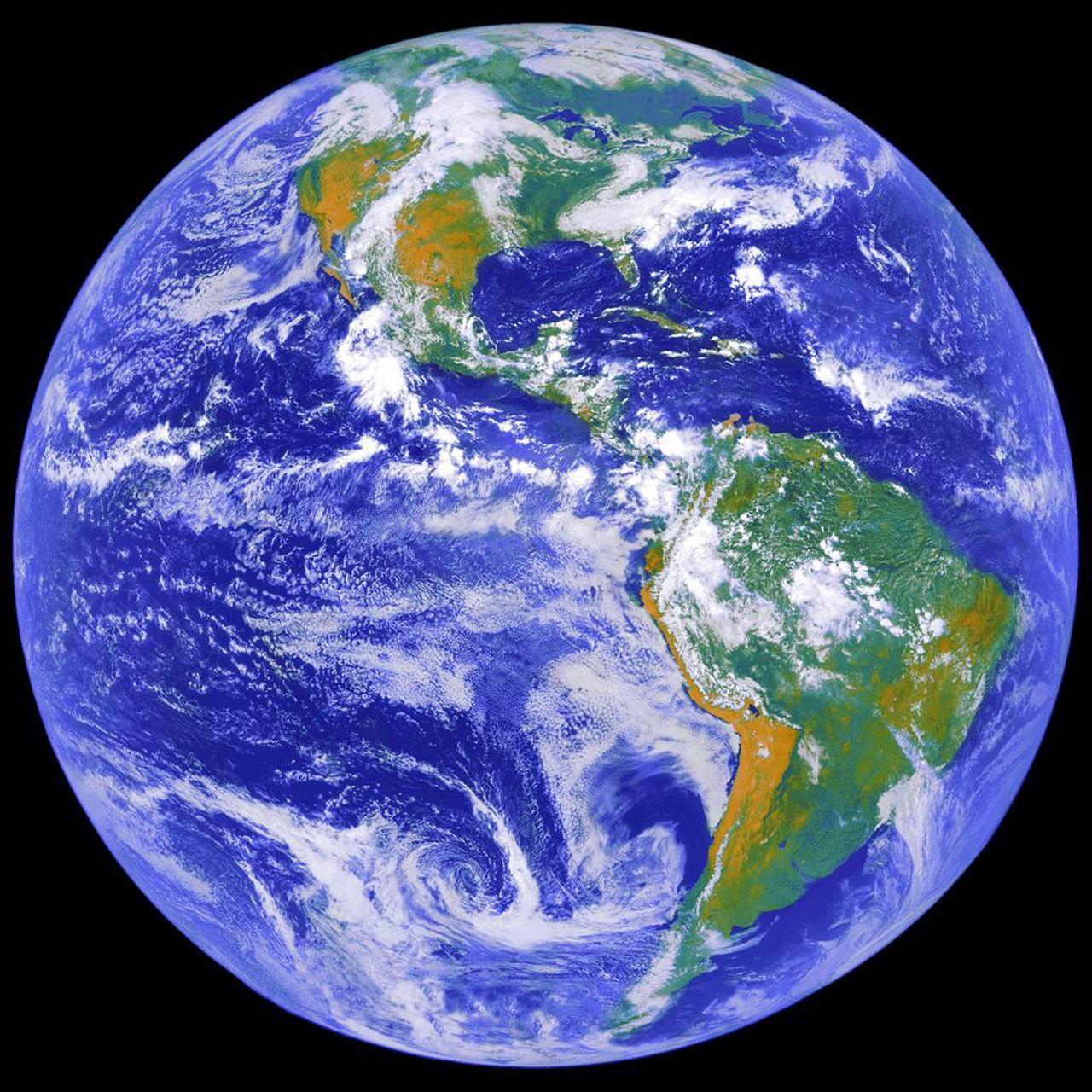
Earth
Behold one of the more detailed images of the Earth yet created. This Blue Marble Earth montage shown above -- created from photographs taken by the Visible/Infrared Imager Radiometer Suite (VIIRS) instrument on board the new Suomi NPP satellite -- shows many stunning details of our home planet. The Suomi NPP satellite was launched last October and renamed last week after Verner Suomi, commonly deemed the father of satellite meteorology. The composite was created from the data collected during four orbits of the robotic satellite taken earlier this month and digitally projected onto the globe. Many features of North America and the Western Hemisphere are particularly visible on a high resolution version of the image. http://photojournal.jpl.nasa.gov/catalog/PIA18033
2012-01-30

Earth - Antarctica Mosaic
This color picture of the limb of the Earth, looking north past Antarctica, is a mosaic of 11 images taken during a ten-minute period near 5:45 p.m. PST Dec. 8, 1990, by NASA’s Galileo imaging system. http://photojournal.jpl.nasa.gov/catalog/PIA00116
1996-02-01

Clementine Images of Earth and Moon
During its flight and lunar orbit, NASA’s Clementine spacecraft returned images of the planet Earth and the Moon. This collection of UVVIS camera Clementine images shows the Earth from the Moon and 3 images of the Earth. The image on the left shows the Earth as seen across the lunar north pole; the large crater in the foreground is Plaskett. The Earth actually appeared about twice as far above the lunar horizon as shown. The top right image shows the Earth as viewed by the UVVIS camera while Clementine was in transit to the Moon; swirling white cloud patterns indicate storms. The two views of southeastern Africa were acquired by the UVVIS camera while Clementine was in low Earth orbit early in the mission. http://photojournal.jpl.nasa.gov/catalog/PIA00432
1999-06-12

Orion and Earth
This first high-resolution image, taken on the first day of the Artemis I mission, was captured by a camera on the tip of one of Orion’s solar arrays. The spacecraft was 57,000 miles from Earth when the image was captured, and continues to distance itself from planet Earth as it approaches the Moon and distant retrograde orbit.
2022-11-16

The Earth and Moon As Seen by 2001 Mars Odyssey Thermal Emission Imaging System
NASA Mars Odyssey spacecraft took this portrait of the Earth and its companion Moon. It was taken at a distance of 3,563,735 kilometers more than 2 million miles on April 19, 2001 as the 2001 Mars Odyssey spacecraft left the Earth.
2001-05-01

One Special Day in the Life of Planet Earth
The cameras on NASA Cassini spacecraft captured this rare look at Earth and its moon from Saturn orbit on July 19, 2013.
2013-07-22

Global View of Earth in the Near-Infrared
This near-infrared photograph of the Earth was taken by the Galileo spacecraft at 6:07 a.m. PST on Dec. 11, 1990, at a range of about 1.32 million miles. South America is prominent near the center. http://photojournal.jpl.nasa.gov/catalog/PIA00226
1996-02-08

Earth - Northeast Africa and the Arabian Peninsula
This image of northeast Africa and the Arabian Peninsula was taken from an altitude of about 500,000 kilometers 300,000 miles by NASA’s Galileo spacecraft on December 9, 1992, as it left Earth en route to Jupiter. http://photojournal.jpl.nasa.gov/catalog/PIA00127
1996-01-29

Juno Approach to the Earth-Moon System
This frame from a movie was captured by a star tracker camera on NASA Jupiter-bound Juno spacecraft. It was taken over several days as Juno approached Earth for a close flyby that would send the spacecraft onward to the giant planet.
2013-12-10

Oblique Shot of Earth
This highly oblique image shot over northwestern part of the African continent captures the curvature of the Earth and shows its atmosphere as seen by NASA EarthKAM. You can see clouds and even the occasional thunderhead.
2008-09-05

Zonally Averaged Carbon Dioxide Concentration from Earth Mid-Troposphere at Different Latitudes, 2002 to 2013
This plot shows the concentration of carbon dioxide in Earth mid-troposphere at various latitudes as measured by NASA Aqua satellite. The colored lines represent different latitude bands that circle Earth, called zones.
2013-05-22

Earth Science
Workers at Launch Complex 17 Pad A, Kennedy Space Center (KSC) encapsulate the Geomagnetic Tail (GEOTAIL) spacecraft (upper) and attached payload Assist Module-D upper stage (lower) in the protective payload fairing. GEOTAIL project was designed to study the effects of Earth's magnetic field. The solar wind draws the Earth's magnetic field into a long tail on the night side of the Earth and stores energy in the stretched field lines of the magnetotail. During active periods, the tail couples with the near-Earth magnetosphere, sometimes releasing energy stored in the tail and activating auroras in the polar ionosphere. GEOTAIL measures the flow of energy and its transformation in the magnetotail and will help clarify the mechanisms that control the imput, transport, storage, release, and conversion of mass, momentum, and energy in the magnetotail.
1992-07-18

Earth and Its Moon, as Seen From Mars
This composite image of Earth and its moon, as seen from Mars, combines the best Earth image with the best moon image from four sets of images acquired on Nov. 20, 2016, by the High Resolution Imaging Science Experiment (HiRISE) camera on NASA's Mars Reconnaissance Orbiter. Each was separately processed prior to combining them so that the moon is bright enough to see. The moon is much darker than Earth and would barely be visible at the same brightness scale as Earth. The combined view retains the correct sizes and positions of the two bodies relative to each other. HiRISE takes images in three wavelength bands: infrared, red, and blue-green. These are displayed here as red, green, and blue, respectively. This is similar to Landsat images in which vegetation appears red. The reddish feature in the middle of the Earth image is Australia. Southeast Asia appears as the reddish area (due to vegetation) near the top; Antarctica is the bright blob at bottom-left. Other bright areas are clouds. These images were acquired for calibration of HiRISE data, since the spectral reflectance of the Moon's near side is very well known. When the component images were taken, Mars was about 127 million miles (205 million kilometers) from Earth. http://photojournal.jpl.nasa.gov/catalog/PIA21260
2017-01-06

Solar System Portrait - Earth as Pale Blue Dot
This narrow-angle color image of the Earth, dubbed Pale Blue Dot, is a part of the first ever 'portrait' of the solar system taken by NASA’s Voyager 1. The spacecraft acquired a total of 60 frames for a mosaic of the solar system from a distance of more than 4 billion miles from Earth and about 32 degrees above the ecliptic. From Voyager's great distance Earth is a mere point of light, less than the size of a picture element even in the narrow-angle camera. Earth was a crescent only 0.12 pixel in size. Coincidentally, Earth lies right in the center of one of the scattered light rays resulting from taking the image so close to the sun. This blown-up image of the Earth was taken through three color filters -- violet, blue and green -- and recombined to produce the color image. The background features in the image are artifacts resulting from the magnification. http://photojournal.jpl.nasa.gov/catalog/PIA00452
1996-09-12

Meandering Path of Earth's Spin Axis
The diagram – based on data used in a July 2024 NASA-funded study – shows polar motion, a phenomenon that results from the combined action of several physical processes that broadly shift the distribution of mass around the globe or create forces in its mantle and core that cause the planet to wobble as it rotates. These changes cause the spin axis to meander over time. The blue line starts at the position of the spin axis near the North Pole in 1900, the first year polar motion data was collected, and tracks it until 2023. The spin axis now sits about 30 feet (10 meters) from where it was in 1900, in the direction of Canada's Baffin Bay. Around 2000, the axis took a sudden eastward turn, which researchers at NASA's Jet Propulsion Laboratory in Southern California in a 2016 study attributed to faster melting of the Greenland and Antarctic ice sheets and groundwater depletion in Eurasia. Surendra Adhikari, a JPL geophysicist who co-authored that study, used measurements from the International Earth Rotation and Reference Systems Service to create the animation. Adhikari and collaborators from Switzerland, Canada, and Germany found in a July 2024 paper in Nature Geoscience that about 90% of repeated oscillations in polar motion between 1900 and 2018 could be explained by large-scale mass redistribution at Earth's surface due to the melting of ice sheets and glaciers and the depletion of aquifers. It also found that nearly all of the long-term, non-repeating drift of the axis was due to dynamics in the mantle. Animation available at https://photojournal.jpl.nasa.gov/catalog/PIA26120
2024-07-19

PREFIRE CubeSat in Earth Orbit (Artist's Concept)
NASA's Polar Radiant Energy in the Far-InfraRed Experiment (PREFIRE) mission will measure the amount of heat Earth emits into space from two of the coldest, most remote regions on the planet. Data from the mission will improve computer models researchers use to predict how Earth's ice, seas, and weather will change in a warming world. This artist's concept depicts one of two PREFIRE CubeSats in orbit around Earth. Earth absorbs a lot of the Sun's energy at the tropics, and weather and ocean currents transport that heat to the poles. Ice, snow, clouds, and other parts of the polar environment emit the heat into space, much of it in the form of far-infrared radiation. The difference between how much heat Earth absorbs at the tropics and then radiates out to space from the Arctic and Antarctic determines the planet's temperature and drives a dynamic system of climate and weather. But far-infrared emissions at the poles have never been systematically measured. This is where PREFIRE comes in. The mission will help researchers gain a clearer understanding of when and where Earth's poles emit far-infrared radiation, as well as how atmospheric water vapor and clouds influence the amount that escapes to space. PREFIRE is composed of two roughly shoebox-size CubeSats outfitted with specialized miniature heat sensors that will give researchers a more accurate picture of how much heat Earth emits into space. https://photojournal.jpl.nasa.gov/catalog/PIA26185
2024-05-15

You are here: Earth as seen from Mars
This is the first image ever taken of Earth from the surface of a planet beyond the Moon. It was taken by the Mars Exploration Rover Spirit one hour before sunrise on the 63rd martian day, or sol, of its mission. The image is a mosaic of images taken by the rover's navigation camera showing a broad view of the sky, and an image taken by the rover's panoramic camera of Earth. The contrast in the panoramic camera image was increased two times to make Earth easier to see. The inset shows a combination of four panoramic camera images zoomed in on Earth. The arrow points to Earth. Earth was too faint to be detected in images taken with the panoramic camera's color filters. http://photojournal.jpl.nasa.gov/catalog/PIA05547
2004-03-11

The Earth from the Moon
The Earth from the Moon
2010-06-24

Earth as Seen from Mars
Earth as Seen from Mars
2005-06-01

Common Craters Earth and Eros
Common Craters Earth and Eros
2000-08-05

Radiation Environment at Mars and Earth
Radiation Environment at Mars and Earth
2003-12-08

NASA Spacecraft Images One of Earth Iceberg Incubators
Acquired by NASA Terra spacecraft, this image shows the west coast of Greenland, one of Earth premiere incubators for icebergs -- large blocks of land ice that break off from glaciers or ice shelves and float in the ocean.
2012-04-13

A NASA Space Sleuth Hunts the Trail of Earth Water
This vertical profile view from the Tropospheric Emission Spectrometer TES instrument on NASA Aura satellite depicts the distribution of water vapor molecules over Earth tropics across one transect of the satellite orbit on January 6, 2006.
2009-08-13

Juno Detects a Ham Radio HI from Earth
During its close flyby of Earth, NASA Jupiter-bound Juno spacecraft listened for a coordinated, global transmission from amateur radio operators using its radio and plasma wave science instrument, known as Waves.
2013-12-10

Earth Science
The LAGEOS I (Laser Geodynamics Satellite) was developed and launched by the Marshall Space Flight Center on May 4, 1976 from Vandenberg Air Force Base, California . The two-foot diameter satellite orbited the Earth from pole to pole and measured the movements of the Earth's surface.
1976-01-01

Cloudy Earth
Decades of satellite observations and astronaut photographs show that clouds dominate space-based views of Earth. One study based on nearly a decade of satellite data estimated that about 67 percent of Earth’s surface is typically covered by clouds. This is especially the case over the oceans, where other research shows less than 10 percent of the sky is completely clear of clouds at any one time. Over land, 30 percent of skies are completely cloud free. Earth’s cloudy nature is unmistakable in this global cloud fraction map, based on data collected by the Moderate Resolution Imaging Spectroradiometer (MODIS) on the Aqua satellite. While MODIS collects enough data to make a new global map of cloudiness every day, this version of the map shows an average of all of the satellite’s cloud observations between July 2002 and April 2015. Colors range from dark blue (no clouds) to light blue (some clouds) to white (frequent clouds).
2015-05-08

Mini Mission RainCube is Sent into Earth Orbit
RainCube was deployed into low-Earth orbit from the International Space Station in July, 2018, where it has been measuring rain and snowfall from space. The size of the tiny weather satellite can be seen in comparison to the Space Station. RainCube is a prototype for a possible fleet of small satellites that could one day help monitor severe storms, lead to improving the accuracy of weather forecasts and track climate change over time. A closer look at these images reveals there are two CubeSats very close together -- RainCube is the bottom CubeSat closer to Earth, while the one above it is HaloSat, used to map the distribution of hot gas in the Milky Way. https://photojournal.jpl.nasa.gov/catalog/PIA22653
2018-09-25

NASA Earth Day 2018
A visitor learns about Earth at one of NASA's exhibits at the Earth Day event on Thursday, April 19, 2018 at Union Station in Washington, D.C. Photo Credit: (NASA/Aubrey Gemignani)
2018-04-19

Where on Earth...? MISR Mystery Image Quiz #26: Costa Rica
This image was acquired by the Multi-angle Imaging SpectroRadiometer instrument aboard NASA Terra spacecraft. This image is from the MISR Where on Earth...? Mystery Quiz #26.
2011-11-02

Where on Earth...? MISR Mystery Image Quiz #27: Jordan
Acquired by the Multi-angle Imaging SpectroRadiometer instrument aboard NASA Terra spacecraft, this image is from the MISR Where on Earth...? Mystery Quiz #27. The location is Jordan.
2012-02-08

Ancient Earth, Alien Earths Event
Dr. Christopher House, Professor of Geosciences, Pennsylvania State University, speaks on a panel at the “Ancient Earth, Alien Earths” Event at NASA Headquarters in Washington, DC Wednesday, August 20, 2014. The event was sponsored by NASA, the National Science Foundation (NSF), and the Smithsonian Institution and was moderated by Dr. David H. Grinspoon, Senior Scientist at the Planetary Science Institute. Six scientists discussed how research on early Earth could help guide our search for habitable planets orbiting other stars. Photo Credit: (NASA/Aubrey Gemignani)
2014-08-20

Ancient Earth, Alien Earths Event
Dr. Timothy Lyons, Professor of Biogeochemistry, UC Riverside, speaks on a panel at the “Ancient Earth, Alien Earths” Event at NASA Headquarters in Washington, DC Wednesday, August 20, 2014. The event was sponsored by NASA, the National Science Foundation (NSF), and the Smithsonian Institution and was moderated by Dr. David H. Grinspoon, Senior Scientist at the Planetary Science Institute. Six scientists discussed how research on early Earth could help guide our search for habitable planets orbiting other stars. Photo Credit: (NASA/Aubrey Gemignani)
2014-08-20

Ancient Earth, Alien Earths Event
An audience member asks the panelists a question at the “Ancient Earth, Alien Earths” Event at NASA Headquarters in Washington, DC Wednesday, August 20, 2014. The event was sponsored by NASA, the National Science Foundation (NSF), and the Smithsonian Institution and was moderated by Dr. David H. Grinspoon, Senior Scientist at the Planetary Science Institute. Six scientists discussed how research on early Earth could help guide our search for habitable planets orbiting other stars. Photo Credit: (NASA/Aubrey Gemignani)
2014-08-20

Ancient Earth, Alien Earths Event
Dr. Dawn Sumner, Professor of Geology, UC Davis, speaks on a panel at the “Ancient Earth, Alien Earths” Event at NASA Headquarters in Washington, DC Wednesday, August 20, 2014. The event was sponsored by NASA, the National Science Foundation (NSF), and the Smithsonian Institution and was moderated by Dr. David H. Grinspoon, Senior Scientist at the Planetary Science Institute. Six scientists discussed how research on early Earth could help guide our search for habitable planets orbiting other stars. Photo Credit: (NASA/Aubrey Gemignani)
2014-08-20

Ancient Earth, Alien Earths Event
Dr. Phoebe Cohen, Professor of Geosciences, Williams College, speaks on a panel at the “Ancient Earth, Alien Earths” Event at NASA Headquarters in Washington, DC Wednesday, August 20, 2014. The event was sponsored by NASA, the National Science Foundation (NSF), and the Smithsonian Institution and was moderated by Dr. David H. Grinspoon, Senior Scientist at the Planetary Science Institute. Six scientists discussed how research on early Earth could help guide our search for habitable planets orbiting other stars. Photo Credit: (NASA/Aubrey Gemignani)
2014-08-20

Earth and Jupiter as viewed from Mars
What does Earth look like when viewed from Mars? At 13:00 GMT on 8 May 2003, NASA Mars Global Surveyor MGS Mars Orbiter Camera MOC had an opportunity to find out.
2003-05-22

Global Accounting of Earth's River Storage and Flow
A paper led by researchers at NASA's Jet Propulsion Laboratory estimates the total volume of water in Earth's rivers – called river storage – on average between 1980 and 2009, and maps out the results for the planet's major hydrological regions. This graphic, adapted from data gathered for the paper, indicates the amount of storage by hydrologic regions that contain one or more river basins, with shades of blue deepening as the amount of storage increases. The paper, published in Nature Geoscience in April 2024, calculated Earth's river storage at about 539 cubic miles (2,246 cubic kilometers), and found that the Amazon River basin, shown in dark blue in South America, was the region with the most storage, with 204 cubic miles (850 cubic kilometers), or about 38% of the global total. The study also estimated the flow of water through more than 3 million segments of river around the world and identified several locations marked by intense human water use, including parts of the Colorado River basin in the United States, portions of the Amazon basin in South America, the Orange River basin in southern Africa, and the Murray-Darling basin in southeastern Australia. https://photojournal.jpl.nasa.gov/catalog/PIA26119
2024-04-26

Earth Science
Workers at the Astrotech processing facility in Titusville prepared for a news media showing of the Geostationary Operational Environmental Satellite-1 (GOES-1). GOES-1 was the first in a new generation of weather satellites deployed above Earth. It was the first 3-axis, body-stabilized meteorological satellite to be used by the National Oceanic Atmospheric Administration (NOAA) and NASA. These features allowed GOES-1 to continuously monitor the Earth, rather than viewing it just five percent of the time as was the case with spin-stabilized meteorological satellites. GOES-1 also has independent imaging and sounding instruments which can operate simultaneously yet independently. As a result, observations provided by each instrument will not be interrupted. The imager produces visual and infrared images of the Earth's surface, oceans, cloud cover and severe storm development, while the prime sounding products include vertical temperature and moisture profiles, and layer mean moisture.
1994-03-08

Earth Observation taken by the Expedition 43 crew.
Earth observation taken during a day pass by the Expedition 43 crew aboard the International Space Station (ISS). Folder lists this as Persian Gulf.
2015-03-13

Solar System Portrait - View of the Sun, Earth and Venus
This color image of the sun, Earth and Venus was taken by the Voyager 1 spacecraft Feb. 14, 1990, when it was approximately 32 degrees above the plane of the ecliptic and at a slant-range distance of approximately 4 billion miles. It is the first -- and may be the only -- time that we will ever see our solar system from such a vantage point. The image is a portion of a wide-angle image containing the sun and the region of space where the Earth and Venus were at the time with two narrow-angle pictures centered on each planet. The wide-angle was taken with the camera's darkest filter (a methane absorption band), and the shortest possible exposure (5 thousandths of a second) to avoid saturating the camera's vidicon tube with scattered sunlight. The sun is not large in the sky as seen from Voyager's perspective at the edge of the solar system but is still eight million times brighter than the brightest star in Earth's sky, Sirius. The image of the sun you see is far larger than the actual dimension of the solar disk. The result of the brightness is a bright burned out image with multiple reflections from the optics in the camera. The "rays" around the sun are a diffraction pattern of the calibration lamp which is mounted in front of the wide angle lens. The two narrow-angle frames containing the images of the Earth and Venus have been digitally mosaiced into the wide-angle image at the appropriate scale. These images were taken through three color filters and recombined to produce a color image. The violet, green and blue filters were used; exposure times were, for the Earth image, 0.72, 0.48 and 0.72 seconds, and for the Venus frame, 0.36, 0.24 and 0.36, respectively. Although the planetary pictures were taken with the narrow-angle camera (1500 mm focal length) and were not pointed directly at the sun, they show the effects of the glare from the nearby sun, in the form of long linear streaks resulting from the scattering of sunlight off parts of the camera and its sun shade. From Voyager's great distance both Earth and Venus are mere points of light, less than the size of a picture element even in the narrow-angle camera. Earth was a crescent only 0.12 pixel in size. Coincidentally, Earth lies right in the center of one of the scattered light rays resulting from taking the image so close to the sun. Detailed analysis also suggests that Voyager detected the moon as well, but it is too faint to be seen without special processing. Venus was only 0.11 pixel in diameter. The faint colored structure in both planetary frames results from sunlight scattered in the optics. http://photojournal.jpl.nasa.gov/catalog/PIA00450
1996-09-13

Earth Day Blog Post
A butterfly sits in the palm of a visitor’s hand at the Kennedy Space Center Visitor Complex in Florida. Kennedy kicked of its annual Earth Day celebrations with a sustainability expo at the visitor complex on April 11, 2019, where butterflies were released throughout the day. Approximately 40 exhibitors from across the nation assembled to provide information ranging from energy-saving solutions to wildlife and natural conservation.
2019-04-11

Earth Day Blog Post
Kennedy Space Center kicked off its annual Earth Day celebrations with a sustainability expo at the center’s visitor complex in Florida on April 11, 2019. Approximately 40 exhibitors from across the nation assembled to provide information ranging from energy-saving solutions to wildlife and natural conservation. In addition, there were multiple butterfly releases held at the expo throughout the day.
2019-04-11

Earth Day Blog Post
A newly released butterfly sits in a cluster of flowers at the Kennedy Space Center Visitor Complex. Kennedy kicked off its annual Earth Day celebrations with a sustainability expo at the center’s visitor complex in Florida on April 11, 2019, which included multiple butterfly releases throughout the day. Approximately 40 exhibitors from across the nation assembled to provide information ranging from energy-saving solutions to wildlife and natural conservation.
2019-04-11

Earth Day Blog Post
A butterfly perches on a visitor’s finger at the Kennedy Space Center Visitor Complex in Florida. Kennedy kicked off its annual Earth Day celebrations with a sustainability expo at the visitor complex on April 11, 2019, where butterflies were released throughout the day. Approximately 40 exhibitors from across the nation assembled to provide information ranging from energy-saving solutions to wildlife and natural conservation.
2019-04-11

Earth Day Blog Post
A visitor transfers a butterfly to a cluster of flowers during one of many butterfly releases held throughout the day at the Kennedy Space Center’s sustainability expo on April 11, 2019. Held at the center’s visitor complex in Florida, the expo kicked off Kennedy’s annual Earth Day celebrations. Approximately 40 exhibitors from across the nation assembled to provide information ranging from energy-saving solutions to wildlife and natural conservation.
2019-04-11

Earth Day Blog Post
Volunteers from the Merritt Island National Wildlife Refuge are photographed with their display during a sustainability expo held at the Kennedy Space Center Visitor Complex in Florida on April 11, 2019. Guests had the opportunity to view their display and receive information on Florida plants and wildlife. The expo kicked off Kennedy’s annual Earth Day celebrations, where approximately 40 exhibitors attended to provide information ranging from energy-saving solutions to wildlife and natural conservation. In addition, there were multiple butterfly releases throughout the day.
2019-04-11

Earth Day Blog Post
Guests view a display set up by Hubbs-Seaworld Research Institute during a sustainability expo held at the Kennedy Space Center Visitor Complex in Florida on April 11, 2019. The expo kicked off Kennedy’s annual Earth Day celebrations, where approximately 40 exhibitors from across the nation assembled to provide information ranging from energy-saving solutions to wildlife and natural conservation. In addition, there were multiple butterfly releases throughout the day.
2019-04-11

Earth Day Blog Post
A newly released butterfly sits in a cluster of flowers at the Kennedy Space Center Visitor Complex. Kennedy kicked off its annual Earth Day celebrations with a sustainability expo at the center’s visitor complex in Florida on April 11, 2019, which included multiple butterfly releases throughout the day. Approximately 40 exhibitors from across the nation assembled to provide information ranging from energy-saving solutions to wildlife and natural conservation.
2019-04-11

Earth Day Blog Post
Members of the Florida Native Plant Society converse with visitors during a sustainability expo held at the Kennedy Space Center Visitor Complex in Florida on April 11, 2019. The expo kicked off Kennedy’s annual Earth Day celebrations. The Florida Native Plant Society was one of approximately 40 exhibitors present at the expo. Exhibitors in attendance provided information ranging from energy-saving solutions to wildlife and natural conservation. In addition, there were multiple butterfly releases throughout the day.
2019-04-11

Earth Day Blog Post
Visitors participate in one of many butterfly releases held throughout the day at the Kennedy Space Center’s sustainability expo on April 11, 2019. Held at the center’s visitor complex in Florida, the expo kicked off Kennedy’s annual Earth Day celebrations. Approximately 40 exhibitors from across the nation assembled to provide information ranging from energy-saving solutions to wildlife and natural conservation.
2019-04-11

Earth Day Blog Post
A member of Brevard Backyard Beekeepers is photographed in front of her display during a sustainability expo held at the Kennedy Space Center Visitor Complex in Florida on April 11, 2019. The expo kicked off Kennedy’s annual Earth Day celebrations, where approximately 40 exhibitors from across the nation assembled to provide information ranging from energy-saving solutions to wildlife and natural conservation. In addition, there were multiple butterfly releases throughout the day.
2019-04-11

Earth Day Blog Post
Kennedy Space Center kicked off its annual Earth Day celebrations with a sustainability expo at the center’s visitor complex in Florida on April 11, 2019. Approximately 40 exhibitors from across the nation assembled to provide information ranging from energy-saving solutions to wildlife and natural conservation. In addition, there were multiple butterfly releases held at the expo throughout the day.
2019-04-11

The Day the Earth Smiled: Sneak Preview
In this rare image taken on July 19, 2013, the wide-angle camera on NASA's Cassini spacecraft has captured Saturn's rings and our planet Earth and its moon in the same frame. It is only one footprint in a mosaic of 33 footprints covering the entire Saturn ring system (including Saturn itself). At each footprint, images were taken in different spectral filters for a total of 323 images: some were taken for scientific purposes and some to produce a natural color mosaic. This is the only wide-angle footprint that has the Earth-moon system in it. The dark side of Saturn, its bright limb, the main rings, the F ring, and the G and E rings are clearly seen; the limb of Saturn and the F ring are overexposed. The "breaks" in the brightness of Saturn's limb are due to the shadows of the rings on the globe of Saturn, preventing sunlight from shining through the atmosphere in those regions. The E and G rings have been brightened for better visibility. Earth, which is 898 million miles (1.44 billion kilometers) away in this image, appears as a blue dot at center right; the moon can be seen as a fainter protrusion off its right side. An arrow indicates their location in the annotated version. (The two are clearly seen as separate objects in the accompanying composite image PIA14949.) The other bright dots nearby are stars. This is only the third time ever that Earth has been imaged from the outer solar system. The acquisition of this image, along with the accompanying composite narrow- and wide-angle image of Earth and the moon and the full mosaic from which both are taken, marked the first time that inhabitants of Earth knew in advance that their planet was being imaged. That opportunity allowed people around the world to join together in social events to celebrate the occasion. This view looks toward the unilluminated side of the rings from about 20 degrees below the ring plane. Images taken using red, green and blue spectral filters were combined to create this natural color view. The images were obtained with the Cassini spacecraft wide-angle camera on July 19, 2013 at a distance of approximately 753,000 miles (1.212 million kilometers) from Saturn, and approximately 898.414 million miles (1.445858 billion kilometers) from Earth. Image scale on Saturn is 43 miles (69 kilometers) per pixel; image scale on the Earth is 53,820 miles (86,620 kilometers) per pixel. The illuminated areas of neither Earth nor the Moon are resolved here. Consequently, the size of each "dot" is the same size that a point of light of comparable brightness would have in the wide-angle camera. http://photojournal.jpl.nasa.gov/catalog/PIA17171
2013-07-22

NASA Radar Images Show How Mexico Quake Deformed Earth
This radar image from NASA Uninhabited Aerial Vehicle Synthetic Aperture Radar UAVSAR shows the deformed Earth caused by a 7.2 earthquake in Mexico state of Baja California in 2010.
2010-06-23

Where on Earth...? MISR Mystery Image Quiz #24: Shandong Province, China
This image of the Shandong Province, China was acquired by the Multi-angle Imaging SpectroRadiometer instrument aboard NASA Terra spacecraft. This image is from the MISR Where on Earth...? Mystery Quiz #24.
2010-11-03

NASA Radar Captures Earth Deformation from 2010 Baja Calif. Quake
This radar image from NASA Uninhabited Aerial Vehicle Synthetic Aperture Radar UAVSAR shows the deformed Earth caused by a 7.2 earthquake in Mexico state of Baja California and parts of the American Southwest on April 4, 2010.
2011-03-04

Concentration of Atmospheric Carbon Dioxide from Earth Mid-Troposphere, 2002 to 2013
This graph made with data from the AIRS instrument on NASA Aqua satellite shows the concentration of carbon dioxide in Earth mid-troposphere, located roughly between 3 to 6 miles 5 to 9 kilometers in altitude.
2013-05-22

Carbon Dioxide in Earth Mid-Troposphere, April 2013 Monthly Average
This map created with data from the AIRS on NASA Aqua satellite shows the concentration of carbon dioxide in Earth mid-troposphere, located roughly between 3 to 6 miles 5 to 9 kilometers in altitude.
2013-05-22

Earth Observation
Earth obsevation taken by the Expedition 40 crew aboard the International Space Station (ISS). Sunrise over Earth limb. Some Window reflections visible.
2014-07-26

Earth Observation
Earth observation taken during a night pass by the Expedition 40 crew aboard the International Space Station (ISS). Folder lists this as: Earth Crescent. Sunrise.
2014-07-31

Earth Observation
Earth observation taken during day pass by an Expedition 36 crew member on board the International Space Station (ISS). Per Twitter message: Simply Earth.
2013-07-31

Earth Science
Small Expendable Deployer System (SEDS) is a tethered date collecting satellite and is intended to demonstrate a versatile and economical way of delivering smaller payloads to higher orbits or downward toward Earth's atmosphere. 19th Navstar Global Positioning System Satellite mission joined with previously launched satellites used for navigational purposes and geodite studies. These satellites are used commercially as well as by the military.
1993-03-29

Earth Science
A Delta II rocket carrying the Geomagnetic Tail Lab (GEOTAIL) spacecraft lifts off at Launch Complex 17, Kennedy Space Center (KSC) into a cloud-dappled sky. This liftoff marks the first Delta launch under the medium expendable launch vehicle services contract between NASA and McDonnell Douglas Space Systems Co. The GEOTAIL mission, a joint US/Japanese project, is the first in a series of five satellites to study the interactions between the Sun, the Earth's magnetic field, and the Van Allen radiation belts.
1992-07-24

Ancient Earth, Alien Earths Event
Panelists pose for a group photo at the “Ancient Earth, Alien Earths” Event at NASA Headquarters in Washington, DC Wednesday, August 20, 2014. The event was sponsored by NASA, the National Science Foundation (NSF), and the Smithsonian Institution and highlighted how research on early Earth could help guide our search for habitable planets orbiting other stars. Photo Credit: (NASA/Aubrey Gemignani)
2014-08-20

Ancient Earth, Alien Earths Event
Dr. David H. Grinspoon, Senior Scientist, Planetary Science Institute, moderates a panel at the “Ancient Earth, Alien Earths” Event at NASA Headquarters in Washington, DC Wednesday, August 20, 2014. The event was sponsored by NASA, the National Science Foundation (NSF), and the Smithsonian Institution and highlighted how research on early Earth could help guide our search for habitable planets orbiting other stars. Photo Credit: (NASA/Aubrey Gemignani)
2014-08-20
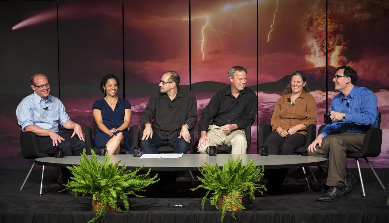
Ancient Earth, Alien Earths Event
Panelists discuss how research on early Earth could help guide our search for habitable planets orbiting other stars at the “Ancient Earth, Alien Earths” Event at NASA Headquarters in Washington, DC Wednesday, August 20, 2014. The event was sponsored by NASA, the National Science Foundation (NSF), and the Smithsonian Institution and was moderated by Dr. David H. Grinspoon, Senior Scientist at the Planetary Science Institute. Photo Credit: (NASA/Aubrey Gemignani)
2014-08-20

Earth Day at Union Station
NASA's Earth Dome is seen at Union Station, Monday, April 22, 2013 in Washington. The Earth Dome housed two of NASA's Science Gallery exhibits as part of a NASA-sponsored Earth Day event at Union Station. Photo Credit: (NASA/Carla Cioffi)
2013-04-22

Earth Day at Union Station
NASA's Earth Dome is seen at Union Station, Monday, April 22, 2013 in Washington. The Earth Dome housed two of NASA's Science Gallery exhibits as part of a NASA-sponsored Earth Day event at Union Station. Photo Credit: (NASA/Carla Cioffi)
2013-04-22
Earth Science
This image depicts a full view of the Earth, taken by the Geostationary Operational Environment Satellite (GOES-8). The red and green charnels represent visible data, while the blue channel represents inverted 11 micron infrared data. The north and south poles were not actually observed by GOES-8. To produce this image, poles were taken from a GOES-7 image. Owned and operated by the National Oceanic and Atmospheric Administration (NOAA), GOES satellites provide the kind of continuous monitoring necessary for intensive data analysis. They circle the Earth in a geosynchronous orbit, which means they orbit the equatorial plane of the Earth at a speed matching the Earth's rotation. This allows them to hover continuously over one position on the surface. The geosynchronous plane is about 35,800 km (22,300 miles) above the Earth, high enough to allow the satellites a full-disc view of the Earth. Because they stay above a fixed spot on the surface, they provide a constant vigil for the atmospheric triggers for severe weather conditions such as tornadoes, flash floods, hail storms, and hurricanes. When these conditions develop, the GOES satellites are able to monitor storm development and track their movements. NASA manages the design and launch of the spacecraft. NASA launched the first GOES for NOAA in 1975 and followed it with another in 1977. Currently, the United States is operating GOES-8, positioned at 75 west longitude and the equator, and GOES-10, which is positioned at 135 west longitude and the equator. (GOES-9, which malfunctioned in 1998, is being stored in orbit as an emergency backup should either GOES-8 or GOES-10 fail. GOES-11 was launched on May 3, 2000 and GOES-12 on July 23, 2001. Both are being stored in orbit as a fully functioning replacement for GOES-8 or GOES-10 on failure.
1994-09-02

Earth Day at Union Station
A participant at a NASA-sponsored Earth Day event puts together a puzzle of the Earth, Monday, April 22, 2013 at Union Station in Washington. (Photo Credit: NASA/Carla Cioffi)
2013-04-22

NASA Earth Day 2019
Visitors view satellite images of Earth at one of NASA's exhibits at the Earth Day event on Monday, April 22, 2019, at Union Station in Washington, D.C. Photo Credit: (NASA/Joel Kowsky)
2019-04-22